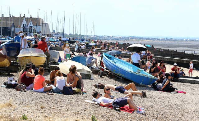
Sun worshippers in the UK have sizzled in the hottest temperature of the year so far, with a scorching 33.3C recorded in England.
The record breaking heat comes as people are being urged to either stay out of the sun or at least avoid being in the sun when it is at its strongest between 11am and 3pm.
The heatwave is to continue across much of England this week, with many areas expected to bask in the high 20s, with others reaching 32C to 34C.
Porthmadog in North Wales had held the record for the hottest day of the year so far, with temperatures reaching 33C (91.4F) on June 28.
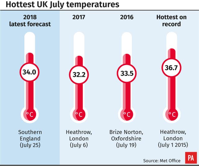
The mercury hit 34.5C (94.1F) at Heathrow on June 21 last year.
An amber “heat health watch” warning has been issued for parts of England this week.
The amber, or level three, warning is issued when temperatures are predicted to hit 30C (86F) during the day, and 15C (59F) at night, for at least two consecutive days.
?️?️?️BREAKING NEWS – it’s the #hottestdayoftheyearsofar with 33.3 °C recorded at Santon Downham in Suffolk ?️?️?️ pic.twitter.com/wMsPfCvAsx
— Met Office (@metoffice) July 23, 2018
There is a 90% possibility of heatwave conditions between 9am on Monday and 9am Friday in parts of England, mainly in the south and east.
The heat health watch warning is designed to make local services aware that these conditions are being met, and for them to take action.
Meanwhile, the Met Office said several places have had 54 consecutive dry days (starting May 30), including a few which have had less than 1mm of rain in the entire 54-day period – the longest spell since 1969, when 70 days passed with no significant rainfall.
The Met Office classifies less than 1.0mm of rain in a day as a “dry day”.
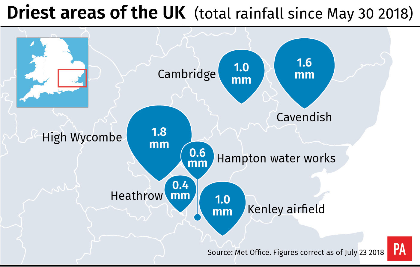
Shoreham Airport is close behind with 53 consecutive days of less than 1mm of rain, and Church Lawford has had 52 consecutive dry days starting on June 1.
The longest run of days with no rain at all this summer so far is 48 days at Brooms Barn, near Bury St Edmunds, since June 5.
The dry spell has been most prolonged in East Anglia and south east England, with the last day of very widespread rainfall for East Anglia and the south east being May 29.
Parts of the Midlands have also been very dry.
A spokesman said: “It’s the driest first half of the summer since 1961.”
He added: “For the UK as a whole, we’ve only seen about 20% of the rainfall we’d normally expect throughout the whole summer.
“Parts of southern England have seen only 6%.”
During the current heatwave, UK temperatures have been approximately 10C higher than average for this time of year.
Instead of 23C (73.4F), which could usually be expected in London in July, temperatures could tip 34C (93.2F).
“There is the chance of a few thunderstorms breaking out over East Anglia on Wednesday, but it is likely to be Friday when we see thunderstorms affecting many central and eastern areas,” he said.
Members of the public were also urged to take the usual precautions in the sun.
Dr Thomas Waite, consultant in health protection at Public Health England, said: “Temperatures are likely be high in parts of England this week, which may leave older people, young children and those with long-term conditions, including heart and lung diseases, struggling to adapt to the heat.
“So keep an eye on friends and family who may be at risk.
“To beat the heat, try to keep out the sun from 11am to 3pm, walk in the shade if you can, apply sunscreen and wear a hat if you have to go out in the heat. Also try to carry water with you when travelling.”