Thunderstorm warnings are still current for most of the UK on Wednesday, while high temperatures are forecast again for many parts of England.
The Met Office has issued a yellow storm warning for all of England and the eastern half of Scotland, with a more serious amber warning pertaining to eastern Scotland between Edinburgh, Inverness and Aberdeen.
An amber warning means people should be on alert for flash flooding and building damage from lightning strikes, floodwaters and hailstones. Delays to public transport, difficult driving conditions and possible road closures could also follow, while deep and fast floodwater could be a threat to human life.
Chief meteorologist Steve Ramsdale said in these areas “exceptional rainfall totals could be seen of 60 millimetres in an hour with a very small chance of 150 millimetres of rainfall in three or four hours”.
The Environment Agency has five flood alerts posted for possible flooding in areas around Birmingham, while 17 flood alerts remain current across Scotland.
Thundery downpours affected the north and northwest of the UK on Monday night and Tuesday morning, with further #thunderstorms affecting E Scotland through the day. England and Wales saw hot #sunshine, although here too a scattering of storms developed through Tuesday pic.twitter.com/AEabOi8QGa
— Met Office (@metoffice) August 11, 2020
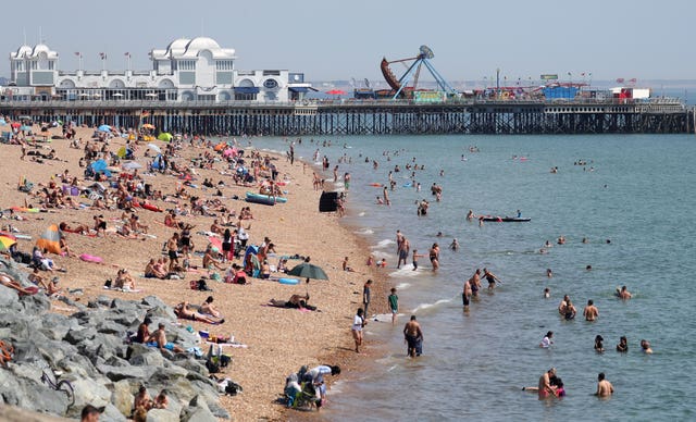
England’s heatwave is set to continue, with London expecting a top temperature today of 31 degrees, which is also forecast for other areas including Cambridge, Yeovil and Southampton.
It will also be warm further north, with Leeds, Sheffield and Nottingham expecting 30 degrees, as is Birmingham and Cardiff.
Ten properties in Lancashire were affected by flooding on Tuesday following overnight storms, the Environment Agency said.
The Environment Agency said further heavy showers could cause more flooding in “mostly urban areas” of England until Friday, with some homes being affected.